Welsh Government geospatial data portal to aid flood response
A new application within the Welsh Government’s geospatial data portal is being developed to aid resilience communities in Wales as severe flooding is expected to grow more frequent.
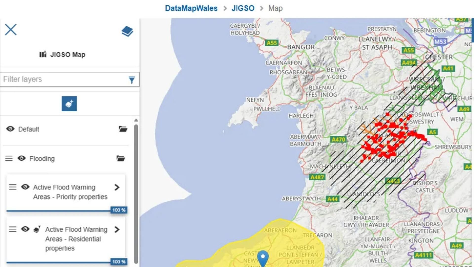
Jigso, which is part of DataMapWales - a platform made in collaboration with Ordnance Survey (OS) - provides emergency services and resilience communities with information on the location of potentially vulnerable properties, facilitating their mitigation and response efforts. This information is produced by combining OS data with additional datasets.
Although still under development, Jigso was used to support first responders in Monmouthshire last year by determining the number of vulnerable households affected by flooding.
Most emergency services, responder agencies, and resilience organisations in Wales have already signed up to access and download the application’s data, while the Welsh Government is also financially backing its further development into a fully supported product.
This application is but one of the faces of DataMapWales, which first began as an environmental tool for the Welsh Government ten years ago and now contains more than 3000 datasets. It is used to provide both the public and local authorities access to data on areas ranging from the location of public toilets to how changes to land affect carbon emissions.
It draws from 35 OS datasets, including OS MasterMap Topography Layer and OS AddressBase, with more to join in the near future. Last year, DataMapWales was used to support the publication of the Welsh Index of Multiple Deprivation.
The portal is also able to host public consultations, having most recently platformed one on Welsh language place names.
Dave Roberts, Head of Geography in the Welsh Government, said that the platform was “constantly evolving”.
He said: “Looking after a smaller country, we are able to work in a very agile way in terms of what we are delivering and how the portal is used.
“Ordnance Survey data provides the backbone of DataMapWales and is key to the success and effectiveness of the platform."
Pam Whitham, Customer Development Manager at OS, in turn said that she was “delighted” by the organisation’s “very close relationship with the Welsh Government”.
She said: “This is a fantastic portal where public sector and service providers across the country are able to access trusted and authoritative data to support their routine and critical services.”
Image credit: DataMapWales / Ordnance Survey