
Interview: 'Un-niching' geospatial data
Geospatial data is by definition ubiquitous and yet it remains a niche asset for the public sector. Often perceived as highly technical information requiring expert skills to extract insights from it, its widespread use is still underway.
Thalia Baldwin, Director at the Geospatial Commission, shares with Government Transformation why geospatial data should be part of the mainstream - and why government needs to continue making progress with data interoperability.
).jpg?width=500&name=Thalia%20Baldwin%20(Presentation%20(169)).jpg)
“Un-niching” location data
Before the Geospatial Commission existed, the UK had a strong geospatial capability. However, this was confined to specific organisations dealing with issues relating to geographic data and mapping, such as Ordnance Survey or HM Land Registry, and local authorities.
It was soon recognised that geospatial data has wider applications beyond specialist organisations, and that its use could positively impact the greater society and economy. And so, in April 2018, the Geospatial Commission was launched within the Cabinet Office as an independent committee of experts tasked with setting the UK’s geospatial strategy.
Baldwin was involved from its inception, moving there from HM Treasury, where she led on the government’s spending approach to digital infrastructure and technologies as Head of Digital Policy, to help set it up and becoming its Director in 2019.
“The Geospatial Commission was set up to provide the missing policy function in the public sector for the UK capitalising on the immense opportunity provided by geospatial data,” Baldwin explains. “We're focused on promoting the UK’s existing capability and then driving more value through targeted data improvement and access programmes and policy.”
The organisation aims to promote the value of geospatial data through enhancing efficiency, unlocking innovation, and enabling better citizen services and infrastructure. To date, its strategy has been targeting “the nuts and bolts” of data improvement.
One of the challenges currently preventing geospatial data from being used more widely is its association with technical concepts and its perception as being complex information with limited uses.
Baldwin’s biggest learning curve has been articulating in simple terms the relevance of geospatial data and location data policy for service development and delivery - what her team calls “un-niching” geospatial data.
“We need to make the application of geospatial data relevant for everybody - to those working in policy as well as those working in data roles,” Baldwin continues.
Mainstreaming geospatial data for the public sector and industry is an essential part of the Geospatial Commission's mission. In 2020, the organisation published its five year strategy, where it identified nine areas where geospatial data can unlock opportunities, including transport, public health, housing, the environment, finance, and more.
Part of this mainstreaming task is keeping up to date and becoming involved with new debates and new thinking on location data, including the emergence of the ‘geoverse’ - a controversial term in the sector because of its links to the metaverse and the ethical and privacy concerns it raises.
“How do we utilise terms like [geoverse] to mainstream geospatial?” asks Baldwin. “I think that's the learning curve that we have gone through and are still going through.”
Simplifying the articulation of geospatial data involves explaining what makes it different from other types of data, says Baldwin. That distinction is a combination of ubiquity, high level of detail, and the power to provide insights and inferences when linked with other data. All these characteristics give geospatial data a “unique power” able to unlock opportunities and applications that can benefit citizens.
What's required is to shift the dial on how the public sector thinks about data importance and transformation.
Any country aspiring to be a tech and innovation powerhouse will need a geospatial strategy in place. Baldwin thinks that the UK is one of the forerunners in the field and is recognised as such.
Geospatial data: not just an add-on
Geospatial data is most valuable when combined with other types of data able to offer insights and analysis. Linked to other records held by government agencies, it could unlock many opportunities for public services, but ongoing interoperability barriers are slowing progress.
Baldwin thinks that there is growing recognition of the need for data interoperability within government, but that there is still some resistance in key departments and agencies.
“I think what's required is to shift the dial on how the public sector thinks about data importance and transformation,” she says. “The public sector is on a transformation journey, and data transformation needs to be accompanied by organisational transformation, including changing culture, mindsets, and capability at the top of organisations.”
The Geospatial Commission has a formal collaboration with six public organisations. One of them is the Valuation Office Agency (VOA), a department closely aligned with HMRC. Although introducing changes in access to HMRC data is a complicated endeavour, Baldwin says that thanks to the Geospatial Commission’s partnership with VAO, they have been able to review whether access to some of their property data can be broadened.
Baldwin highlights the work that the Geospatial Commission is doing with multiple departments to ensure that there are not siloed approaches to using location to inform land use policy.
A project on this is the National Land Use Data programme: a pilot into the access challenges to location data that is exploring whether better data about land use can help inform the optimal use of land for policy priorities such as housing development, food production and large scale infrastructure projects.
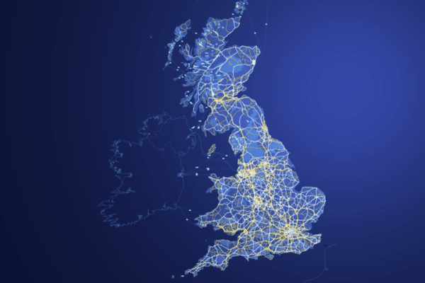
This programme complements the Geospatial Commission's National Underground Asset Register, which is building a digital map of the UK's utilities networks, bringing together policy on underground assets, such as water or energy pipes or telecommunications cables, which usually sits across different organisations.
When looking at data transformation in government, Baldwin advises to think about the big picture: “There's no point implementing a system change if your organisation doesn't believe in it or understand it.”
In the case of geospatial data, there is a continuous need for making the case that this type of data is essential to public sector policy and delivery: “It’s not just an add-on; it complements and augments technologies such as 5G, AI or wireless networks.”
.jpg?width=600&name=20201110_085942%20(2).jpg)