Geospatial Commissioner: Innovation v Standards
Steve Unger joins Government Transformation Magazine to explain the power of location data in reaching net zero and the art of designing data standards. He is a Board member of the Geospatial Commission, part of the Department for Science, Innovation and Technology.
Location game
Transport was the largest emitting sector of GHG emissions in 2021 producing 26% of the UK’s total emissions in 2021. Location data is set to play a key role in realising the government’s net zero GHG emissions by 2050. For Steve, this means collaboration with the Department for Transport. When the government set the target for 300,000 public electric vehicle charge points by 2030, Steve’s team was pivotal in integrating geospatial analytics into this target, recognizing, “this was not just a numbers game, it was also a location game”.
 He emphasises, “To make drivers comfortable about adopting EVs, they have to know that they will be able to find a charge point near their desired location. Even better, if we can get to the point where drivers can book access to that nearby charge point in real-time, and just turn up, that will make a massive difference to driver confidence, and hence to our ability to hit net-zero targets”.
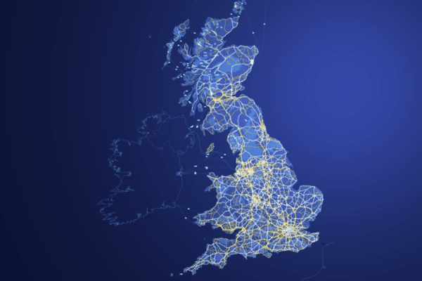
The emerging National Underground Asset Register (NUAR) also marks a high point in Steve’s term as Commissioner. Around 4 million km of pipes, electricity and telecoms cables and sewers are buried underground. Roughly speaking, a hole is dug every seven seconds to access these, causing 60,000 accidental strikes per year and costing the UK economy £2.4 billion a year. By creating a digital twin of underground pipes and wires, NUAR will make it possible to manage underground infrastructure more efficiently, minimise disruption to traffic and ensure that those working on our infrastructure can do so more safely.
Steve notes, “The project has had to deal with some technical issues, but the biggest practical challenge was bringing together the 700+ organisations which own underground assets and getting them to share their data. We made it happen by using our role as a facilitator to bring people together, get hold of the data and put it all in one place where it was usable by different utility operators”.
To standardise or not to standardise?
Steve told us, “It is a perennial problem. The truth is, when you are dealing with historical data from many different sources, there is no such thing as a standard. Legacy systems are an inevitability and all you can do is promote the adoption of common measures and practices over time. The best way forward is to discover the best way of holding a particular form of data and then gradually persuade people to adopt that approach”.
Standards imposed centrally also risk harming innovation. “Uniformity is not only unrealistic, it is also undesirable since it prevents people from trying different things. We do want different datasets to be interoperable, as a form of federated database, but it can be dangerous to aim for a monolithic 'single version of the truth'. The Geospatial Commission has adopted a set of principles for geospatial data, which it calls Q-FAIR. These require data to be Findable, Accessible, Interoperable, Reusable and of good quality”.
Data ethics
The Geospatial Commission has done work on the application of data ethics to geospatial data, publishing an ‘ABC of ethical use’. There are several such frameworks and the key challenge for all of them is how to build trust. Steve suggests that there are many ways of achieving this and it is important to be realistic about what works for citizens, “When I fly on an aeroplane, I trust that the jet engine is going to work without anyone explaining to me the mechanics of the jet engine”. Steve's point is that we use multiple technologies without explaining exactly how they work, but people need to be reassured that there is some form of independent oversight and accountability.
There’s a great deal of interest in Large Language Models at the moment, for example, which have recently been combined with geospatial data to address the need for non-technical users in local government to make effective and informed decisions around local planning. Steve acknowledges the excitement, but urges caution. He warns, “Humans need to be in the loop if you are making sensitive decisions. It comes down to accountability.”
International developments
Much of the work with geospatial data is global, so international cooperation is important. The Geospatial Commission recently held an international summit, bringing together representatives from 15 different countries. The summit’s roundtables included one chaired by Steve on the use of geospatial data to build resilience to various types of climate-related risk. He found the perspectives of different countries, with different risk profiles, fascinating.
Asked to identify three countries with lessons for the UK around geospatial data, he identified Canada, Singapore and the US. “Canada is fascinating, it is such a big country. The challenge of delivering rural connectivity, a particular interest of mine, is of a different order to those we face. Singapore has been particularly creative in exploring new uses of data, within a relatively permissive regulatory environment, making this a market to watch. I think you always have to have an eye on the United States since so much of the innovation that goes on is driven by US companies. If I talk to my kids about geospatial data, they think of Google Maps and Uber”.
Final thoughts
We asked Steve what he wanted to achieve during his time as Commissioner. He said, “I like interesting problems where the output makes a real difference to people's lives. If NUAR makes it easier to build networks, bring less disruption and save lives through safe working, that is fantastic. I am a policy geek but what really motivates me is taking policy to the point where lives have been improved”.


).jpg?width=600&name=Thalia%20Baldwin%20(Presentation%20(169)).jpg)